Santa Cruz Island
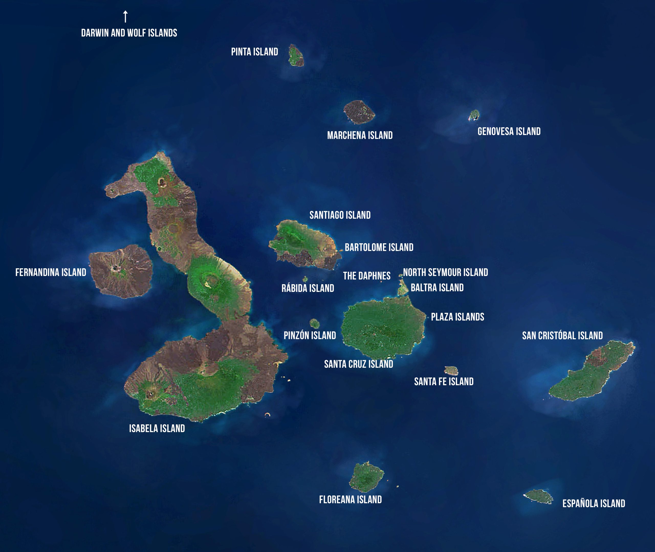
Santa Cruz Island
Area: 986 km2 or 381 mi2
Maximum Altitude: 864 m or 2835 ft
Human Population: Approximately 12,000
HISTORY
Volcanic activity has long since ceased on Santa Cruz, the second largest of the Galápagos Islands and located in the center of the archipelago. The name Santa Cruz is Spanish for “Holy Cross,” but its English name — Indefatigable — was named for the British vessel HMS Indefatigable. Santa Cruz has a long history of human settlement and agriculture, which has left the landscape permanently altered by invasive species. Human development began in the 20th century on Santa Cruz when settlers from the United States and Europe moved to the area between WWI and WWII. The variety of geology, wildlife, and vegetation attracted settlers. The small towns of Bellavista and Santa Rosa were established in the humid highlands, where farmers raised cattle and planted crops such as avocados, coffee, sugarcane, bananas, oranges, and lemons.
TODAY
Santa Cruz is the main tourism hub for all of Galápagos, given its proximity to the airport on Baltra to the north. It is the only island in Galápagos where tourists can readily experience the interior and higher elevations of a Galápagos island. Santa Cruz has the longest paved road in Galápagos, which runs north-south across the island, taking people from the airport ferry at Itabaca Canal on the north coast into the highlands and through a few smaller towns on its way down to Puerto Ayora, the island’s largest city located on the southern coast of the island in Academy Bay.
CONSERVATION CHALLENGES
The Galápagos Islands have experienced accelerated development due to recent rapid growth in both tourism and population. Santa Cruz Island, and more specifically the town of Puerto Ayora, has withstood the brunt of this growth. In addition to the problem of introduced species and the ever-greater probability of introductions, this growth has put increasing pressures on local resources and municipalities in terms of health, education, waste management, and many other aspects of daily life. For example, until recently, the waste produced by the community was taken to a dump where no treatment was performed. In 2006, through the joint efforts of the community and the Galápagos National Park, the “Fabricio Valverde Environmental Center” was established outside of Puerto Ayora to provide recycling of 40% of the waste materials generated in Santa Cruz.
Conservation of nature can only be achieved when the local population is sustainable, both economically and in terms of resources.
City: Puerto Ayora
Situated in Academy Bay on the southern coast of Santa Cruz, Puerto Ayora is a port town where sailboats fill the bay, sea birds fill the air, and marine iguanas dot the shore. Puerto Ayora is the heart and soul of the Galápagos Islands’ human population and is the main tourism hub in the archipelago.
Known for its quaint hotels with creative architecture and small restaurants with delicious seafood, Puerto Ayora is the base point for most tours and offers the most services in Galápagos, including a hospital, banks, post office, radio station and a LATAM airline office. Most travelers to the Galápagos will make a stop in Puerto Ayora during their trip.
Puerto Ayora also offers the most options for tourists who prefer to sleep ashore. There are a variety of day tours available allowing visitors to design their own Galápagos experience. Day-trips to a number of the islands, kayaking, tours of the highlands, hiking, dive trips, mountain biking, and horseback riding are just a few of the activities visitors can arrange in Puerto Ayora. It is also home to the headquarters of the Galápagos National Park and the Charles Darwin Research Station (see visitor site).
City: Bellavista
The village of Bellavista is located 7 km inland from Puerto Ayora. It is the second largest population center on the island. Once a farming center, it is now also the center of a housing boom with more residential properties for many who work in Puerto Ayora. The town is the starting point for hikes or horse rides to Media Luna and Cerro Crocker at the top of the island. Various farms around both Bellavista and Santa Rosa have restaurants and some have opportunities for visitors to go underground into lava tubes.
City: Santa Rosa
Santa Rosa is a smaller community in the highlands of Santa Cruz. It is the center of a farming community. The town is the starting place for hikes to the Tortoise Reserve (either La Caseta or El Chato) and the road out to Salasaca where there is a road down through private property to El Chato. Various farms around both Bellavista and Santa Rosa have restaurants and some have opportunities for visitors to go underground into lava tubes.
These eerie formations offer a fascinating look into the volcanic belly of the island. The lava tubes were formed when surface lava cooled and solidified, while the underground hot lava continued to flow, eventually leaving an emptied cave. Some of these mysterious tunnels can be explored with torch and headlamp. Access to most of the lava tubes is on private land where a small fee is charged. The larger, more complex tubes require descent by ladder.
Visitor Site: Charles Darwin Research Station / Fausto Llerena Tortoise Center
A ten minute walk from the center of town, the Charles Darwin Research Station is the operational center of the international non-profit Charles Darwin Foundation. A visit to the Charles Darwin Research Station is included in many cruises. The visitor center contains exhibits dealing with climate and geography and provides insight into the evolution of flora and fauna as well as current conservation programs. The Darwin Station conducts research and provides technical assistance to other researchers and governmental agencies, in particular the Galápagos National Park. The results of the research are published in scientific journals, reports, and also included in interpretive displays for visitors. The Darwin Station also provides environmental education to communities and schools in Galapagos.
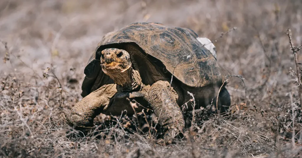
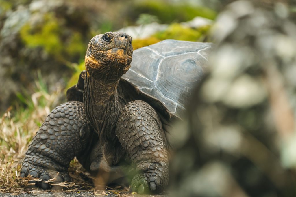
The Fausto Llerena Tortoise Center, a long-term program run jointly by the Galápagos National Park Directorate and the Charles Darwin Foundation, began in 1965 to save the giant tortoise population on Pinzón. It was quickly expanded to include other populations, in particular that of Española where only 14 individuals remained. As of 2008, more than 4,000 young tortoises from eight different populations have been repatriated to their island of origin, with nearly 1,500 going back to Española. At the Tortoise Center, visitors can observe a variety of tortoises, including hatchlings, juveniles, and full-grown individuals.
Visitor Site: Las Grietas (The Crevices) and El Mirador
In addition to the CDRS and the Tortoise Center, there are two additional visitor sites within a short distance of Puerto Ayora. Given their proximity to town, they are accessible without a guide.
To reach Las Grietas, the visitor must take a water taxi from the municipal pier to the pier of Finch Bay Hotel on the other side of the bay. From there the trail passes by lagoons, a beach, and the residential zone until reaching the cliffs of the main crevice. Care is needed in climbing down into the crevices. There, it is possible to observe two very distinct levels of water – fresh water at the surface and the salt water of the sea at the bottom. The crevices are a lovely place to swim.
El Mirador can be accessed from Puerto Ayora by foot, bicycle, or car. It is off the road to Baltra a short way out of town. It is a partially collapsed lava tube. Because it is short, visitors can enter without a flashlight. The lava tube is located in the arid zone where many of Darwin’s finches can be observed. A barn owl is frequently seen living inside the tube.
Visitor Site: Tortuga Bay, Playa de los Perros, and Garrapatero
Visitors staying on Santa Cruz have three wonderful beach opportunities, none of which require a guide.
The trail to Tortuga Bay starts from the main street in Puerto Ayora and takes about an hour. The trail goes through the arid zone and many land birds can be seen along the way. Once at the shore, there are two beaches, the long beach open to the ocean has strong undercurrents and only strong swimmers should enter there. The second beach is to the north within Tortuga Bay. There, the water is calm.
Playa de los Perros is a very short beach (only 75 m) out on the western outer point of Academy Bay. It is reached by an 8-minute boat ride from the municipal pier followed by a ½ km or so of rough trail. There is also a white-tipped shark pond where visitors can watch the sharks.
Garrapatero is a long white beach (approximately 1,500 m long) located approximately 19 km to the northeast of Puerto Ayora. It can be reached by boat (20 minutes) or car, through Bellavista and Cascajo (50 minutes). From the parking area there is a walk of just less than 1 km to the beach. In addition to the beautiful beach, there is a lagoon where flamingos and White-cheeked Pintail Ducks can sometimes be observed. Many birds found in the arid zone as well as shorebirds can be seen there.
Camping is allowed at both Tortuga Bay and El Garrapatero by special permit from the Park.
Visitor Site: Highlands & Tortoise Reserve
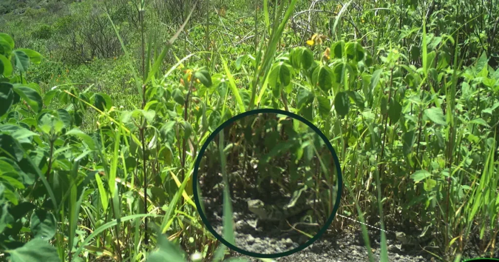
Journeying across Santa Cruz into the highlands, visitors are delighted by the island’s variety of life and geology. Beginning at the coast and traveling north along the road to Baltra, the road climbs through the agricultural zone and into the mist-covered forests of the highlands. Santa Cruz possesses all of the various life zones present in the archipelago, with wonderful birding opportunities. Whether it’s the bright red feathers of a Vermilion Flycatcher or one of Darwin’s finches almost every land bird present in the islands can be found here.
Santa Cruz also offers excellent opportunities for viewing wild tortoises, both roaming through pastures in the agricultural zone and in the Tortoise Reserve, which is accessible from Santa Rosa or Salasaca. Several farms serve food and allow visitors to explore their grounds in search of tortoises. Descending through the agricultural zone into the Transition Zone where the Tortoise Reserve is located, the introduced vegetation of the farmlands is replaced by native vegetation. The pond at El Chato is surrounded by forest where short-eared owls, Darwin’s finches, Vermilion Flycatchers, Yellow Warblers, Galápagos Rails, and Paint-billed Crakes can be seen. As the visitor walks into the forests overgrown with lichens, ferns, and other epiphytes, it is time to listen carefully for the sound of heavy footsteps and the sound of shrubs being slowly crushed as the tortoises make their way through the brush.
Visitor Site: Los Gemelos (Twin Craters)
These two large pit craters along the road from Puerto Ayora to Baltra were caused by the collapse of empty magma chambers. Visitors can stop along the side of the road and visit both craters, walking around their rims. A circular trail to the larger crater passes through the beautiful Scalesia forest, which is an excellent place to observe terrestrial birds, including Vermilion Flycatchers, Short-eared Owls, the Galápagos Dove, and several finch species.
Visitor Site: Media Luna (Half Moon) and Cerro Crocker (Crocker Hill)
The hike to the top of the island begins in Bellavista. The trail leads up first to Media Luna, the remaining half of a crater, shaped like a half moon. Media Luna sits in the middle of the Miconia Zone – named for an endemic shrub species that is found only in the highlands of Santa Cruz and San Cristóbal. Unfortunately this unique vegetation zone has been seriously threatened both by fire and introduced plants. Media Luna is the site of the one of the main Galápagos petrel nesting colonies. The nests are burrows or caves in the walls of the crater. Galapagos rails are often seen in this area as well.
The trail beyond Media Luna leads to Puntuda, an old splatter cone, and Cerro Crocker at the highest point of the island, with a wide vista of the southern seas and the town of Puerto Ayora.
Visitor Site: Black Turtle Cove
A dinghy ride into Black Turtle Cove, located on the north coast of Santa Cruz, a bit west of Baltra, provides a window into a quiet Galápagos hideout. Once into the cove, the boat continues with its engines off and begins to explore the mangrove-sheltered cove. Sea turtles feed and mate in the calm waters and three species of sharks are found there – the black-finned reef shark, the white-tipped reef shark, and the Galápagos shark. Groups of spotted rays are also often seen – as are egrets and lava herons.
Visitor Site: Las Bachas
A bit west of Black Turtle Cove is Las Bachas, a sandy white-coral beach that is a major nesting site for sea turtles. A lagoon behind the first beach often has flamingos, white-cheeked pintail ducks, and migratory birds. The first beach is excellent for swimming. The remains of a floating dock used by Americans during World War II can be found there. The name “Las Bachas” resulted from poor pronunciation on the part of some locals when saying “barges” – as remains of barges from WW II were found there.
Visitor Site: Cerro Dragón (Dragon Hill)
Dragon Hill is one of the few visitor sites directly related to a conservation program of the Charles Darwin Foundation and the Galapagos National Park. In 1975 the population of land iguanas of northeast Santa Cruz, as well as at Cartago Hill on Isabela, were decimated by feral dogs. The breeding and rearing program for land iguanas was begun as an emergency response to this devastation. In addition to the breeding program at the Charles Darwin Research Station, 38 land iguanas were released on the nearby islet of Venecia. This semi-captive population lives under natural conditions. However, the islet had no suitable area for nesting. Therefore, approximately 100 m3 of soil was moved from Santa Cruz to Venecia to create an artificial nesting area. The population thrived. The program has been very successful and the last land iguana was repatriated to Dragon Hill from the Iguana Center in 1991. The population on Venecia continues to grow and iguanas continue to be transferred to Dragon Hill approximately every three years. The visitor site was opened in 1993 to provide an additional chance for observing land iguanas. The landing site at the rocky shore is a wonderful place for snorkeling. Heading inland on the trail, visitors pass two small salt-water lagoons where it is sometimes possible to see flamingos and other shore birds. The trail continues on and circles Dragon Hill where visitors can observe land iguanas and their many burrows on the hillside.
Visitor Site: Venecia
North of Dragon Hill visitors can travel by dinghy to visit the islets of Venecia. The boat ride goes through a series of channels between the islets providing the opportunity to view rays, sharks, and sea turtles, which rest in the calm waters of the coves and channels. Land iguanas can sometimes be observed from the dinghy. The landscape of the islets provides a fascinating look into volcanic formations.
Visitor Site: Whale Bay
One of the least visited sites, Whale Bay is an open area where visitors can wander a bit. The boundary is a semicircle that extends 250 m around the base of the hill. Climbing the hill is best done from the inland southern side. The beach is green-colored due to the olivine crystals found in the sand. Ceramic pieces are sometimes found in the area and must be left in place. There is no verified information about the origin of the ceramic but there were two or three houses at Whale Bay in 1846. According to the captain of the Genie, this site had the only trail to the highlands, which served for obtaining fresh water. It is believed that various men lived here for a time and worked harvesting a species of lichen, Rocella tinctoria, which was used as a dye.
Visitor Site: South Plaza
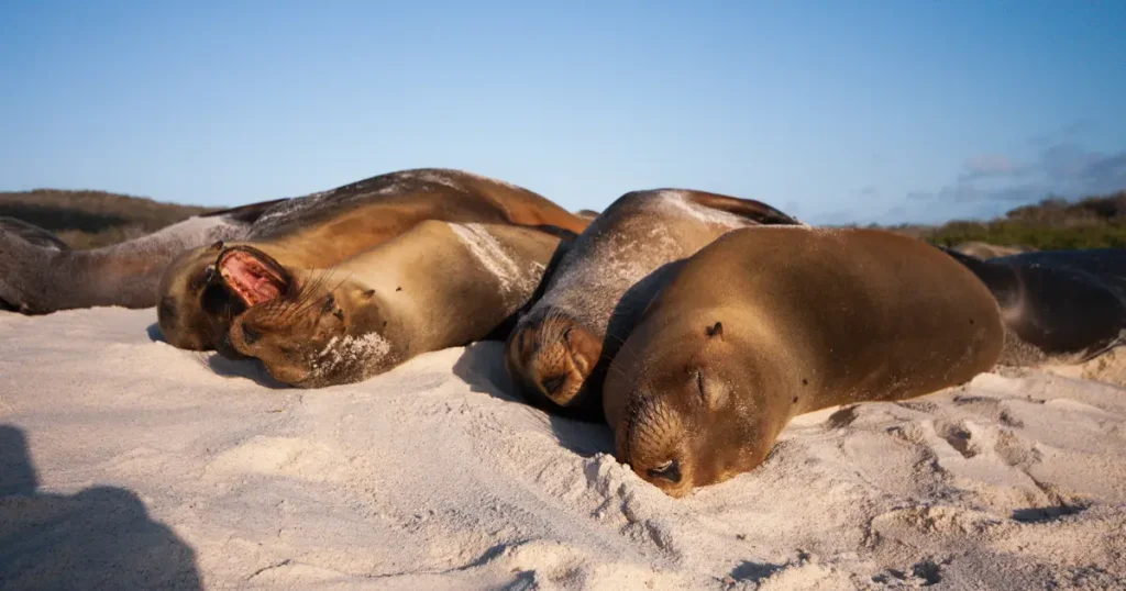
The Plazas Islands are twin islands off the east coast of Santa Cruz. North Plaza is closed to visitors while South Plaza is one of the highly preferred visitor sites. Both islands were formed by geological uplift and tilt to the north, with cliffs on their southern coasts. Despite its small size, South Plaza is home to a large number of species, including a large population of sea lions, a healthy population of land iguanas – some of the smallest in the islands, numerous marine iguanas, and cliffs full of nesting seabirds, such as Swallow-tailed Gulls, Red-billed Tropicbirds, Audubon’s Shearwaters, Nazca Boobies, and several other species. Much of the island is covered with Sesuvium, a succulent plant species that is green to yellowish in the wet season and a bright red in the dry season. The island also has a forest of large, prickly pear cactus, which provides food for the land iguanas. The circular trail leads up to the 25-m-high cliff on the south side of the island where many seabirds nest. Occasionally hybrid iguanas have been observed on South Plaza, the result of a cross between a male marine iguana and a female land iguana. These iguanas are peculiar with a mix of characteristics from the two species of iguanas.
Marine Dive Sites: 6 sites
Six dive sites are located around Santa Cruz. These include: Guy Fawkes Rocks, Punta Carrión, Gordon Rocks, South Plaza, Caamaño Islet, and Punta Estrada. Many of these sites provide viewing of sea lions, sea turtles, various species of sharks and eels, and schools of pelagic fishes. Gordon Rocks, just to the east of Islas Plazas, is one of the most visited dive sites for day tours out of Puerto Ayora. There divers can observe hammerhead sharks, Galápagos sharks, manta rays, eagle rays, sea turtles, schools of fishes, sea lions, and fur seals. The underwater walls of the rocks have a high abundance of sessile organisms creating a spectacular color array.
Conservation Site: Cottony Cushion Scale
The introduced cottony cushion scale insect has been attacking mangrove stands as well as other tree species throughout Galápagos. After careful trials, the first ever recorded introduction into Galápagos of a species for the purpose of biological control took place when the Australian ladybug Rodolia cardinalis was released to combat the scale insect. In areas where monitoring has occurred, the positive effects are very clear. Before the release of Rodolia cardinalis, the mangrove stands of the town of Puerto Ayora on Santa Cruz Island were blackened and dying from the effects of the cottony cushion scale. These mangroves are now green and thriving.
Conservation Site: Education
Education is one of the foundations for achieving long-term results in conservation. Research and other projects of the Charles Darwin Foundation aim to involve the local population in order to create community-based solutions with a conservation vision. The CDF also provides scholarship support to local students to participate in study programs in areas such as organic farming, sustainable agriculture and other related careers. Fundación Galápagos coordinates educational cruise programs for students and parents to the various islands, in order for them to become better acquainted with the incredible natural world of the archipelago.
Conservation Site: Fabricio Valverde Environmental Center
The Fabricio Valverde Environmental Center was created in 2006 for both solid waste management and environmental education. The Environmental Center has four main sections: the Depot for recycling solid waste, the Composting Plant for organic material, the Hospital Waste Incinerator, and the Interpretation Center for Solid Wastes. An educational campaign has been carried out in the communities of Santa Cruz to increase public participation in recycling. The education campaign resulted in a major increase in the recycling rate, with the monthly quantity of recycled material in Santa Cruz doubling from 17 to 35 tons from May 2007 to May 2008.
Conservation Site: Native Plant Nursery
The Charles Darwin Foundation has been working for several years to promote the use of native and endemic plants in gardens and thus discourage residents of Galápagos from introducing ornamental plants to the islands. The CDF has two nurseries in Santa Cruz, where over 60 plant species are produced using seeds, cuttings or transplants of seedlings from degraded areas. Over 9,000 plants have now been provided to individuals, schools and colleges, businesses and institutions. The CDF is also working with residents to develop their own micro-companies. Thus far, the project has trained five residents of the islands to raise plants and design and maintain gardens, with the aim of creating their own “micro- landscape design companies.” One such micro-company has already been formed on the island of Floreana by a project participant. Native gardens have been planted at the university, various schools, tour agencies, hotels, stores, restaurants and 16 other institutions, including the Municipality of Santa Cruz, the Harbor authorities, AGROCALIDAD, and MAGAP. Model native gardens were seeded on CDF grounds to motivate the local community to plant their own gardens with native species. Many families in the community are already putting into practice this important step for conservation.